Southern Thailand is facing a rapidly intensifying flood emergency, with Songkhla declaring Hat Yai and nearby districts as red zones and ordering urgent evacuations. Heavy monsoon rainfall continues to batter the region, while satellite data confirms large-scale flooding across at least six provinces.
Crisis Deepens in Songkhla (Updated November 23, 2025)
At a meeting held at the Songkhla Provincial Hall on November 23, Governor Rattasart Chidchoo led the Provincial Disaster Command Centre in reviewing the worsening situation and enforcing immediate response measures.
Widespread Impact: November 19–23
Flooding across Songkhla has affected:
- 16 districts
- 100 subdistricts
- 637 villages
- More than 465,000 people
- 235 residents evacuated
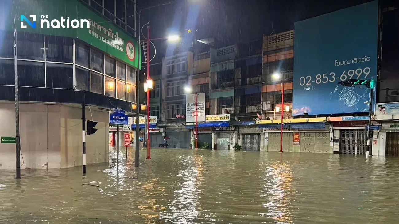
The hardest-hit districts are Hat Yai, Rattaphum, and Na Mom. Hat Yai alone has over 243,000 affected residents, with significant flooding in urban areas and water levels in Khlong U-Taphao approaching overflow.
Additional districts placed under close surveillance include Thepha, Na Thawi, Saba Yoi, Ranot, Krasae Sin, and the Sathing Phra peninsula.
Emergency Orders and Response Operations
Following Deputy Prime Minister Anutin Charnvirakul’s inspection on November 22, authorities have accelerated all emergency actions.
1. Forward Command Centre in Hat Yai
A frontline emergency centre has been set up in Hat Yai, led by a deputy governor, to manage evacuations and coordinate rescue operations.
2. Deployment of Vehicles and Boats
Rescue units have mobilised:
- Military high-clearance trucks
- DDPM emergency vehicles
- Flat-bottom boats
- Additional vessels requested from other government agencies
Priority rescue groups include children, the elderly, the sick, and vulnerable residents.
3. Hotel Evacuations
Military teams have been assigned to evacuate people stranded in hotels after power outages in severely flooded areas.
4. Large-Scale Water Drainage
Over 80 water pumps have been installed at 68 key locations to speed up water removal from critical communities.
5. Daily Relief Distribution
The Songkhla Red Cross and Provincial Administrative Organisation are preparing 20,000 meal boxes per day for affected districts.
Authorities have been instructed to keep lines open for all emergency calls and prepare for post-flood compensation and recovery once water levels begin to fall.
Satellite Data: 228,060 Rai Flooded Across Six Provinces
GISTDA’s analysis of Radarsat-2 satellite imagery (November 22, 2025) shows severe flooding across:
- Nakhon Si Thammarat
- Phatthalung
- Songkhla
- Trang
- Satun
- Surat Thani
Key findings:
- Total flooded area: 228,060 rai
- Water depth: mostly over 1 metre
- Areas affected: low-lying farmland, riverside communities, and major transport routes, several of which are impassable
The data has been shared with national agencies to support rescue planning and damage assessment.
(Note: Satellite estimates have not yet been confirmed by field inspections.)
Initial Damage in Songkhla
- 1 house completely destroyed
- 3 houses partially damaged
- Shops, schools, temples affected
- Over 4,000 rai of farmland damaged, especially in:
- Rattaphum
- Krasae Sin
- Sathing Phra peninsula
Weather Outlook
The Southern Eastern Meteorological Centre reports that heavy to very heavy rain will continue across the lower South from November 23–25 due to a strong monsoon trough. Although the system may shift toward the Andaman Sea after November 24, water levels in major canals remain dangerously high.
Authorities are maintaining 24-hour patrols in high-risk zones.
Public Advisory
Residents in Hat Yai, Na Mom, Rattaphum, Ranot, and other vulnerable areas are urged to follow official warnings closely and stay alert to evacuation orders.
How to Check Near-Realtime Flood Information
- Website: disaster.gistda.or.th
- Mobile app: Search “เช็คน้ำ” (Check Nam) on iOS or Android for live water-level maps and alerts.
ref: https://www.nationthailand.com/news/general/40058674